Key points:-
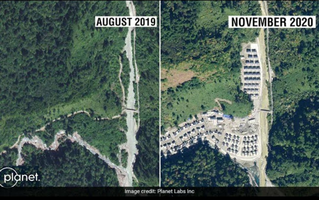
- The village consists of 101 homes, satellite images show
- New village in Arunachal Pradesh nearly 4.5 km in Indian territory.
- China claims Arunachal Pradesh as part of southern Tibet, while India contests it.
According to reports China has constructed a new village in Arunachal Pradesh, consisting of about 101 homes, show satellite images.
The village, located on the banks of the River Tsari Chu, lies in the Upper Subansiri district, an area which has been long disputed by India and China and has been marked by armed conflict.
China claims Arunachal Pradesh as part of southern Tibet, while India contests it.
The Foreign Minister was also sent the satellite images, did not challenge what the pictures show. “We have seen recent reports on China undertaking construction work along the border areas with India. China has undertaken such infrastructure construction activity in the past several years.”
The government says it remains committed to improving border infrastructure. ”Our Government too has stepped up border infrastructure including the construction of roads, bridges etc, which has provided much needed connectivity to the local population along the border.”
However, Foreign Ministry’s did not directly respond to a question on whether the construction of the village was diplomatically raised with China. Instead the ministry said: “Government keeps a constant watch on all developments having a bearing on India’s security and takes all the necessary measures to safeguard its sovereignty and territorial integrity.”
Significantly, Bharatiya Janata Party MP from Arunachal East Tapir Gao has repeatedly raised the matter of Chinese incursion in several parts of the state. The Army had denied his claimed when he first mentioned the matter in September 2019. However, he raised the matter in Lok Sabha yet again in November 2019.
In an interview in June last year, he mentioned Upper Subansiri district as one of the areas where incursions took place. On Monday, Gao said that construction by the Chinese was still going on. “China has entered more than 60-70 kms inside the upper Subansiri district if you follow the path along the river,” he said. “They are constructing a road along the river known locally as the Lensi as it flows in the direction of the Subansiri river.’’
“It is an extraordinarily serious issue as it has many other implications elsewhere on the boundary,” Claude Arpi, an expert in India-China relations, told the news channel. Arpi also confirmed that the village was “well south of the McMahon line and the Indian perception of the Line of Actual Control”.
McMahon Line is the demarcation between Tibet and India’s North East, which New Delhi believes marks the boundary between India and China in the region. But this is disputed by Beijing.

